Area Description
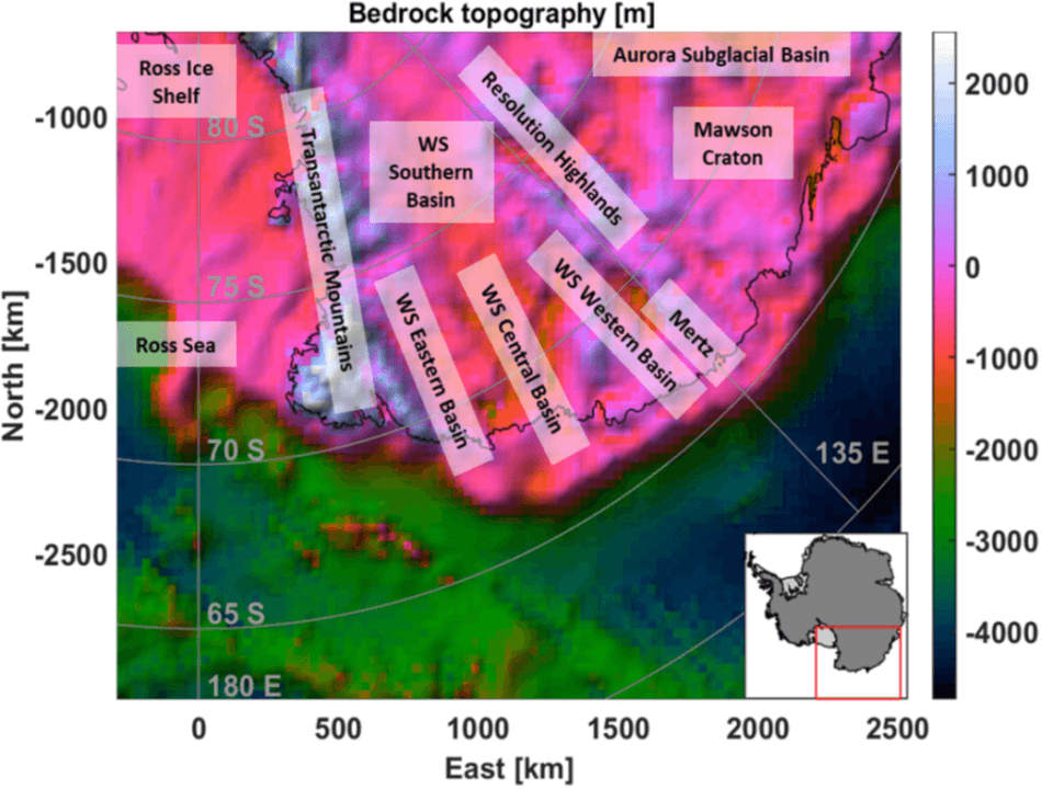
The area is characterized by the presence of a large subglacial depression, the Wilkes Basin, representing one of the main topographic features of the East Antarctica Ice Sheet. It is delimited by the TAM, a 4000 km long mountain range that separates East Antarctica
from the West Antarctic Rift System and the Queen Mary Land. The region is of important to understand the tectonic evolution of the East Antarctic Craton and to constrain models of the super-continent cycle.
Gravity Data
- Compilation of latest GGMs
- Grids of other derived products, derivatives and transforms (e.g. full tensor, THD, Tilt Angle etc.)
- Spatial Resolution: 15 km
Geological Data
- Full 3D geological model in terms of density distribution
- Regular grids of principal geological horizons (ice top, ice bottom, bedrock, basement and Moho) build from a compilation of latest available models.
- Spatial resolution: 15 km
Further Insight
The available results of a gravity constrained Bayesian inversion performed with proprietary software are:
- Full 3D geological model in terms of density distribution
- Regular grids of pricipal geological horizons
- Spatial resolution: 15 km
Results have been published in Capponi, M., Sampietro, D., Ebbing, J., & Ferraccioli, F. (2022). Antarctica 3-D crustal structure investigation by means of the Bayesian gravity inversion: the Wilkes Land case study. Geophysical Journal International, 229(3), 2147-2161.