Area Description
The region is quite complex and is characterized by the presence of the Hellenic subduction zone which accommodates the convergence between the African plate and the Anatolian–Aegean block. Key elements of the area are the presence of several trenches (Ptolemy, Pliny and Strabo), mainly developing in the South-West North-East direction, and of a complex faults system.
Gravity Data
- Compilation of latest GGMs combined with shipborne data
- Grids of gravity anomalies and other derived products, derivatives and transforms (e.g. full tensor, THD, Tilt Angle etc.)
- Spatial Resolution: 1 km
Magnetic Data
- Compilation of shipborne dataset and global magnetic field models
- Grid of total magnetic anomaly
- Spatial Resolution: 1 km
Geological Data
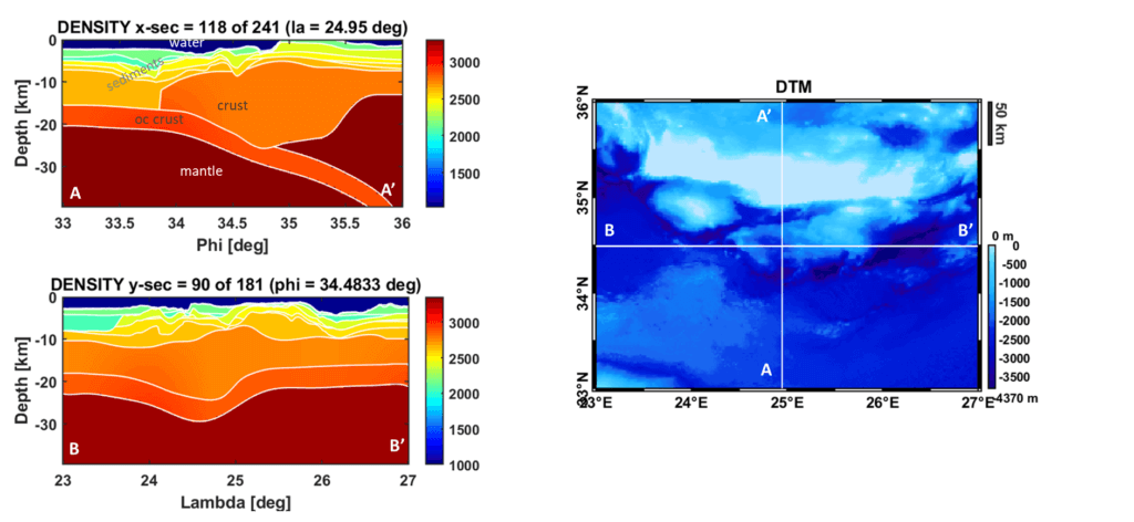
- Full 3D geological model in terms of density distribution
- Regular grids of principal geological horizons (bathymetry, various sediments layers, basement, Moho and subduction zone) build from a compilation of latest available models
- Spatial resolution: 1 km
Further Insight
The available results of a gravity (and joint gravity and magnetic) constrained Bayesian inversion are.
- Full 3D geological model in terms of density distribution
- (Full 3D geological model in terms of magnetic susceptibility)
- Regular grids of principal geological horizons
- Spatial resolution: 1 km
Results have been presented in Sampietro, D., Capponi, M., Oikonomopoulos, K., Ktenas, D., Tartaras, E., & Stefatos, A. (2021, December). 3D model of South Crete offshore area by seismic constrained gravity inversion. In Third EAGE Eastern Mediterranean Workshop (Vol. 2021, No. 1, pp. 1-3). European Association of Geoscientists & Engineers.