Area Description
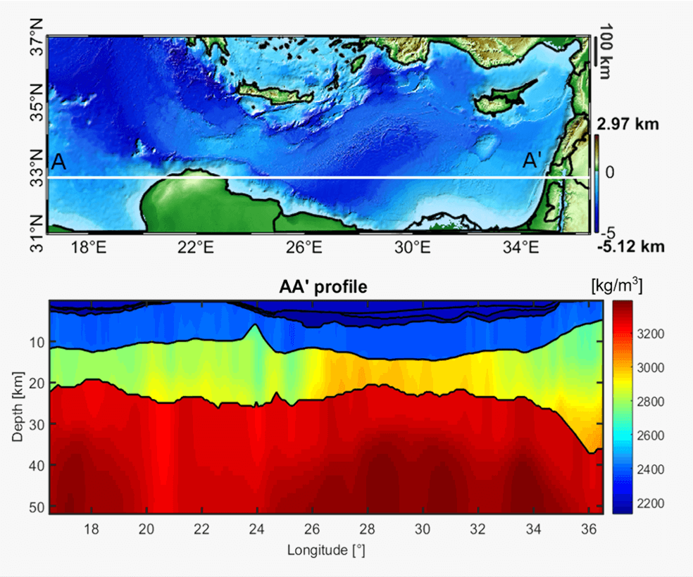
The study area extends from 16.5° E to 36.5° E in longitude and from 31° N to 37° N in latitude for a total of about 2000 km x 600 km. The Central-Eastern Mediterranean area includes regions quite well understood and others that are still matter of investigation. The region is characterized by the presence of a variety of tectonic units: there is an ancient oceanic crust in correspondence of the Ionian and of the Herodotus basins, the Mediterranean Ridge (an accretionary wedge caused by the African plate subducting under the Eurasian and Anatolian plates) running from the south of Crete to the southwest corner of Turkey and eastwards south of Cyprus, the Hellinic and Cyprus Arcs, related as well to the subduction of the African plate, a continental crust in correspondence of the Levantine basin and a thinner continental crust in the Sirte basin.
Gravity Data
- Compilation of latest GGMs combined with terrestrial shipborne dataset
- Grids of gravity anomalies and other derived products, derivatives and transforms (e.g. full tensor, THD, Tilt Angle etc.)
- Spatial Resolution: 1.5 km
Geological Data
- Full 3D geological model in terms of density distribution
- Regular grids of principal geological horizions (bathymetry, Plio-Quaternary sediments bottom, Messinian sediments bottom, basement and Moho) build from a compilation of latest available models
- Spatial resolution: 1.5 km
Further Insight
The available results of a gravity constrained Bayesian inversion performed with proprietary software are:
- Full 3D geological model in terms of density distribution
- Regular grids of principal geological horizons
- Spatial resolution: 1.5 km